New study of the 2014 Oso landslide

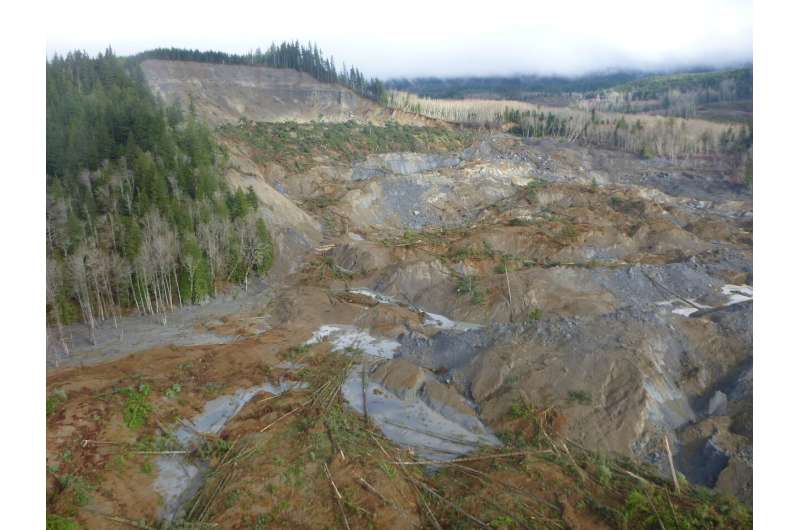
As a compelling example of a large-mobility landslide, the 22 March 2014 landslide near Oso, Washington, USA, was particularly devastating, traveling across a 1-km-plus-wide river valley, killing 43 people, destroying dozens of homes, and temporarily closing a well-traveled highway.
To resolve causes for the landslide's behavior and mobility, Brian Collins and Mark Reid of the U.S. Geological Survey conducted detailed post-event field investigations and material testing of soils involved in the failure.
How far a landslide moves from the site where it began can, of course, vastly amplify the consequences of slope failure. Some landslides stop moving close to where they began, and others are very mobile and can travel long distances, affecting not only what is located at the base of the slope, but also farther away.
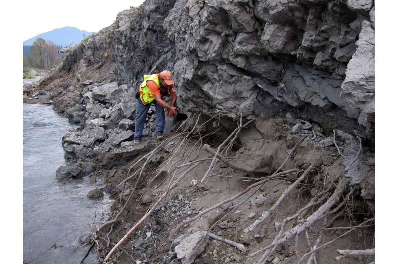
Collins and Reid mapped the geology and structure of the Oso landslide deposit by making multiple visits to the site over the course of three years. Some of the data they collected were highly ephemeral, being obscured by erosion and vegetation within one year of the landslide and highlighting the need to record many observations within a few months of the disaster.
Using "boots-on-the-ground" geologic mapping techniques, combined with high-resolution orthoimagery and airborne LiDAR data, they reconstructed the likely sequence of events that led to the landslide's large mobility. Their mapping and analyses show that the approximately nine-million-cubic-meter landslide underwent rapid extension or stretching in a closely timed sequence of events that led to the landslide overrunning the, at-the-time, saturated flood plain forming the valley floor.

The large and rapid failure of the landslide caused the flood plain, composed of alluvial sands and gravels, to liquefy through a process of pore-pressure generation and consequent liquefaction. Liquefaction greatly reduced the strength along the base of the landslide and enabled it to travel over 1 km across the valley flats.
Collins and Reid found extensive evidence of high soil-water pore pressure during their field work by identifying and mapping of hundreds of "sand boils"—typically decimeter-sized cones of sand that indicated locations where liquefied alluvium tried to escape from a weakened base beneath the landslide. In their new GSA Bulletin article, Collins and Reid present their mapping and interpreted landslide sequence, as well as analyses that show how the basal liquefaction mechanism likely occurred at the site of the Oso landslide. They hypothesize that this mechanism might enhance mobility of other landslides in similar settings.
More information: Brian D. Collins et al, Enhanced landslide mobility by basal liquefaction: The 2014 State Route 530 (Oso), Washington, landslide, GSA Bulletin (2019). DOI: 10.1130/B35146.1
Provided by Geological Society of America


