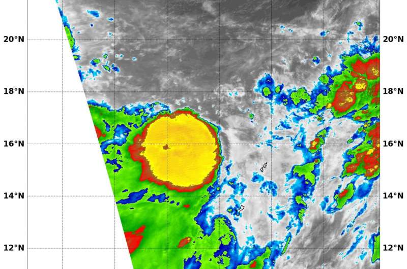
NASA's Terra satellite provided infrared data on Tropical Depression on Aug. 18 near Guam in the northwestern Pacific Ocean. Credit: NASA
NASA's Terra satellite captured an infrared image of the developing Tropical Storm 10W in the Northwestern Pacific Ocean near Guam.
The Moderate Resolution Imaging Spectroradiometer or MODIS instrument aboard NASA's Terra satellite provided an infrared look at Tropical Depression 10W on Aug. 18. 10W has some strong thunderstorms around the center of circulation that appeared to have cold top temperatures as cold as minus 80 degrees Fahrenheit (minus 62.2 degrees Celsius). Cloud tops that cold are high into the troposphere (lowest layer of the atmosphere) and have the potential to generate heavy rainfall.
At 11 a.m. EDT (1500 UTC) on August 18, 2016 Tropical Depression 10W was centered near 16.5 degrees north latitude and 143.4 degrees east longitude, about 189 nautical miles north-northeast of Andersen Air Force Base, Guam. 10W has tracked north-northwestward at 10.3 mph (9 knots/16.6 kph) and is expected to continue moving in that direction. Maximum sustained winds were near 34.5 mph (30 knots/55.5 kph).
The Joint Typhoon Warning Center forecast calls for Tropical Storm 10W to move in a generally northerly direction over the next several days while intensifying slightly to a minimal tropical storm. The forecast takes 10W to the central part of the big island of Japan by Aug. 22 and 23.
Provided by NASA's Goddard Space Flight Center


